Fire blight simulation
A ‘war gaming’ workshop was held in Melbourne on 19 and 20 April, at which the spatial simulation model and the structured decision-making process developed by the Communicating Uncertainties in Biosecurity Adaption (CUBA) project were showcased, using the example of fire blight in the Goulburn Valley, Victoria.
The workshop was for one half of the CUBA project, which has been working towards a spatial incursion simulation model and a structured decision-making approach for Apple & Pear Australia Ltd. The other half of the project involves the Australian Banana Grower’s Council, and their interest in non-spatial models.
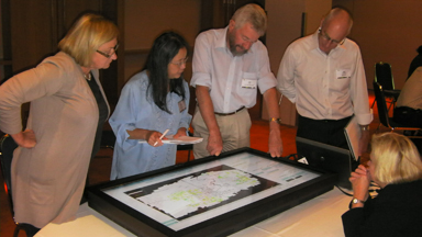
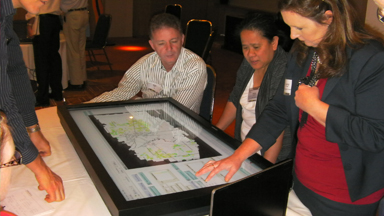
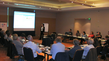
The workshop was attended by 24 people from across the industry. The attendees had an opportunity to work in small groups to manage a ‘virtual’ fire blight incursion in the Goulburn Valley using the model projected on to large touch screens. They could physically place initial infections, monitor detection and spread of infections, alter destruction and buffer zones, look at the effect of seasonal factors (i.e. blooming periods where honeybees are most active and can spread infections), and decide on overall strategies for short and long-term management (i.e. eradication, contain/slow the spread, or live with it).
They could also ‘shock’ the model at random times to represent a bad year in which the disease pressure (i.e. spread) was high. This was to give the effect of random adverse climatic conditions conducive to faster-than-average disease spread.
The project, as well as the overall goal of the workshop, was to improve the uptake of uncertain information using maps, as opposed to statistical models. When an event occurs in the ‘here and now’, decision-makers tend to have a lot of information about it, and therefore think of it in detail terms. But, when an event like a pest incursion is more distant into the future, decision makers have less available and reliable information about it, causing them to think in more abstract terms about it.
Furthermore, words and statistics carry the essence of the referent event, but pictures are concrete representations that carry the properties of an invasion event in full detail. Therefore, when a decision-making group is psychologically ‘near’ to an event, pictorial representations of it are more effective decision aids than words and statistics.
Generally, in terms of the war games against fire blight in the Goulburn Valley, it was found that incursions which occurred in relatively isolated patches of the Valley could be contained if they were detected early enough, even in high disease pressure periods. However, if infection was not detected early and occurred in areas with abundant apple and pear orchards, the disease could quickly take hold.
The CUBA project provides a virtual world in which incursion management hypotheses and strategies can be formulated, tested and embedded within incursion response plans. Here, a process of trial and error can be used because mistakes are costless. With time and further refinement, the lessons learned in this virtual world will pay dividends in real incursion management situations. The motto is ‘practice makes progress’, because we can never hope to be perfect.
The CUBA team is led by Dr David Cook (Senior Economist, DAFWA) and involves key researchers Dr Shuang Liu (Research Scientist, CSIRO Ecosystem Sciences), Dr Jean-Philippe Aurambout (Senior GIS Scientist, DPI Victoria), Dr Oscar Villalta (Senior Research Scientist, DPI Victoria) and Dr Darren Kriticos (Principal Research Scientist, CSIRO Ecosystem Sciences).
Some pictures from the war games workshop:
Back to The Leaflet.